Why Flood Risk Has to Come Before the Floor Plan
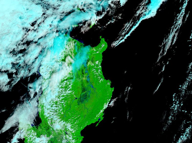
Most house-hunting checklists lead with bedroom count, commute time, and price per square meter. Flood risk usually shows up last, if at all, because it's invisible on a dry-season site visit. That ordering is backwards for the Philippines: a mispriced flood-prone lot doesn't just cost you in repairs, it drags down resale value, spikes fire and flood insurance premiums, and can leave a property literally unsellable after a bad typhoon season makes local headlines.
The good news is flood risk is actually verifiable before you sign anything, using free government tools most buyers never open.
How to Check If a Property Actually Floods
HazardHunterPH (hazardhunter.georisk.gov.ph) is the starting point. It's a multi-agency tool led by DOST-PHIVOLCS, with PAGASA, DENR-MGB, DENR-NAMRIA, and OCD contributing data. Pin the exact lot coordinates and it generates a report covering flood susceptibility, storm surge exposure, liquefaction risk, and distance to the nearest active fault, all in one PDF, free.
PAGASA's Flood Hazard Maps add a second, more flood-specific layer, color-coded low, medium, and high flood susceptibility down to the barangay level. Cross-checking both tools catches discrepancies a single source might miss.
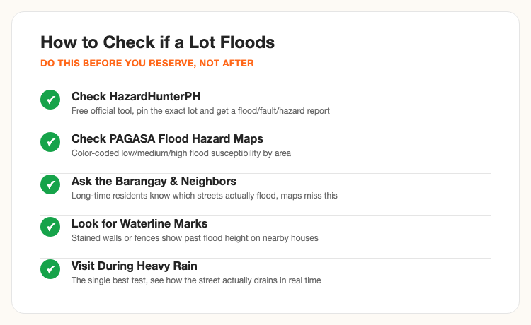
Maps only go so far. Talk to the barangay office and long-time neighbors, they know which specific streets flood every habagat season even when the official map marks the general area as low risk, drainage problems are often hyperlocal. Look for waterline stains on walls, fences, and utility posts on nearby older houses, a visible tide mark two feet up a neighbor's fence tells you more than any map legend. And if you can manage it, visit the lot during actual heavy rain, not just a scheduled sunny-day site visit, watching how water moves (or doesn't) on the actual street is the single most reliable test available.
The Full Buying Process, Step by Step
1. Engage a licensed broker or go direct to an accredited developer. A PRC-licensed real estate broker isn't required by law for every transaction, but for a first-time buyer it catches title and paperwork issues before they become expensive problems.
2. Shortlist and verify. For pre-selling units, confirm the developer's current DHSUD License to Sell and Certificate of Registration, this single check filters out unlicensed or high-risk projects immediately. For resale or ready-for-occupancy units, pull the Transfer Certificate of Title (TCT) at the Registry of Deeds and check for existing liens, adverse claims, or unpaid real property tax.
3. Reserve. A reservation fee (commonly ₱20,000 to ₱100,000 depending on the project) holds the unit while you finalize financing, usually credited toward the down payment.
4. Sign the Contract to Sell and arrange financing. Whether paying via in-house financing, bank mortgage (Pag-IBIG or commercial), or cash, this is also the point to lock in the payment schedule.
5. Execute the Deed of Absolute Sale and transfer the title. Pay Documentary Stamp Tax (1.5% of the selling price or zonal value, whichever is higher, buyer-side by custom) and, if applicable, Capital Gains Tax (6%, seller-side by custom). The BIR then issues an electronic Certificate Authorizing Registration (eCAR), the document that lets the Registry of Deeds actually transfer the title into your name.
Ready-for-occupancy transactions typically close in 30 to 90 days. Pre-selling projects run 2 to 5 years from reservation to turnover, factor that timeline into any urgency around your current housing situation.
Subdivision vs Other Property Types
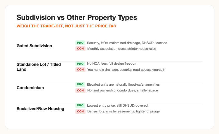
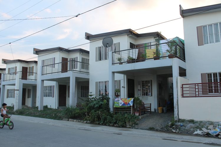
A gated, DHSUD-licensed subdivision comes with an engineered drainage plan reviewed before the license to sell was ever issued, plus HOA-maintained common areas and security, in exchange for monthly association dues and stricter house rules (paint colors, fence height, renovation approval). A standalone titled lot skips the dues and rules entirely but puts drainage, security, and road access fully on you. A condominium, especially an elevated unit in a mid- or high-rise, is often the most inherently flood-safe option by design, though you own the unit, not land, and pay ongoing condo dues. Socialized or row housing offers the lowest entry price and is still DHSUD-covered, but denser lot layouts mean smaller easements and tighter drainage margins.
Top Flood-Safer Locations and Developers
Elevated terrain isn't evenly distributed. In Metro Manila, Quezon City's Diliman ridge area (Loyola Heights, Santa Mesa Heights) sits on genuinely higher ground. BGC in Taguig was master-planned relatively recently with modern drainage infrastructure baked in. Parts of Muntinlupa and Las Piñas away from Laguna Lake and its tributary creeks fare better than the lakeside stretches. East of the metro, Antipolo and upper Rizal towns sit in the foothills above typical flood level, though landslide risk becomes the trade-off to check instead in steeper subdivisions.
On the flood-prone side, the Marikina River valley, low sections of Cainta and Pasig near that same river, the KAMANAVA belt (Caloocan, Malabon, Navotas, Valenzuela) with its tidal flooding, and older Manila districts like España, Sampaloc, and Quiapo flood fast in heavy rain due to aging drainage. None of this means a good property can't exist within these areas, it means individual-lot verification matters more there than anywhere else.
On the developer side, Ayala Land (Alviera, Vermosa), Filinvest (Filinvest City Alabang, Timberland Heights), and Megaworld lead in large-scale master-planned townships with reviewed drainage systems as part of the original site design, since flood management at that scale gets engineered in from day one rather than patched later. Vista Land and DMCI Homes cover a wider range of price points with the same DHSUD-reviewed process behind each project. A recognized developer name isn't a flood guarantee on its own, it does mean a documented, reviewed drainage plan exists to check.
Flood-Safer Areas Outside Metro Manila
Flood risk isn't a Metro Manila-only problem, and buyers relocating to Cebu or Davao need their own local map, not a Manila checklist applied elsewhere. In Cebu, MGB-7 lists Mandaue, Talisay, Cebu City, and Consolacion among the most flood-vulnerable, Mandaue alone has roughly 40% of its population in flood-exposed areas, and Talisay subdivisions near the coast, including parts of Pueblo San Ricardo, have flooded during recent typhoons. Higher ground in the Cebu City uplands, Busay and parts of Talamban, sits well above the coastal flood zone, at the cost of steeper terrain and a longer commute to the CBD.
In Davao City, the flood risk concentrates around the Matina, Talomo, Davao, Bunawan, and Lasang river systems, several barangays there, including Matina Pangi, Matina Aplaya, and Talomo Proper, have been placed under a state of calamity after past flooding. Shrine Hills sits on genuinely high, steep ground above the Matina lowlands, but that elevation brings its own landslide risk on the steeper slopes, so a Davao buyer is trading one hazard for another rather than eliminating risk outright, another reason to run the specific lot through HazardHunterPH rather than assuming "uphill" automatically means safe.
Investment Factors Beyond the Flood Check
Flood risk directly affects resale value and financing. Banks and in-house financing providers increasingly factor flood history into appraisal, and a property with a documented flood incident can face a lower loan-to-value ratio or higher insurance premiums down the line. Beyond that single factor, weigh proximity to planned infrastructure (new MRT/LRT extensions, expressway interchanges tend to lift nearby property values over a 5 to 10 year horizon), elevation relative to the surrounding block (not just the general district), and the developer's post-turnover drainage maintenance track record, an HOA that lets silted canals go unmaintained for years defeats even a well-engineered original plan.
For an investment property specifically, flood-safer locations command a real premium per square meter, but that premium is usually smaller than the long-run cost of a flood-prone property's depressed resale value and elevated insurance cost. Run both numbers, not just the sticker price, before deciding.
Frequently Asked Questions
Sources: HazardHunterPH, PAGASA Flood Hazard Maps, and DHSUD's public developer licensing records. Flooded street photo: NASA/MODIS Rapid Response, public domain. Subdivision photo: Wikimedia Commons, CC BY-SA 3.0. This article is general educational information, not legal, financial, or engineering advice, verify current flood data, licenses, and titles directly with the relevant agency before any purchase.